2006-2011 Mechanisms
Producing Variation in Lake Salinity in Dune Environments: Nebraska Sand Hills (funded by National Science Foundation,
Principal Investigator). Lake salinity
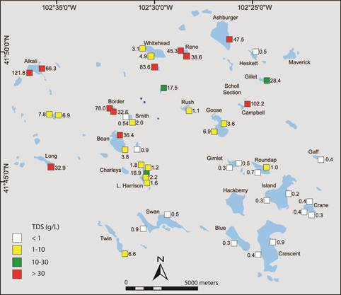
in the Sand Hills, Nebraska the largest sand dune area in the Western
Hemisphere (58,000 km2) ranges over three orders of magnitude from
fresh (0.1 g/L) to brine (>100 g/L), while groundwater is fresh. Solute
advection, diffusion, dispersion, variable-density flow in ground water, and
eolian transport of dust forms of salts control divergence of salinity paths
between different lakes. This study utilizes modeling, geophysics (electrical
resistivity imaging, electromagnetic methods), drilling and direct push, remote
sensing (Landsat imagery), geochemistry and terrain analysis in
Publications
Befus, K., M. B. Cardenas,
J.B. Ong, and V.A. Zlotnik, 2012,
Classification and
delineation of groundwater - lake interactions in the Nebraska Sand Hills (USA)
using quasi-3D electrical resistivity surveys, Hydrogeology Journal, in press
Zlotnik, V.A., J.B. Ong, and J.D. Lenters, J. Schmieder,
S.C. Fritz, 2012, Quantification of salt dust pathways from a groundwater-fed
lake: implications for solute budgets and dust emission rates, J. Geophys. Res., v.
117, F02014, doi:10.1029/2011JF002107
Ong, J., J. Lane, V. Zlotnik, T.
Halihan, and E. White, 2010, Combined use of frequency-domain electromagnetic
and electrical resistivity surveys to delineate near-lake groundwater flow in the
semi-arid Nebraska Sand Hills, USA, Hydrogeology Journal, 18, no
6, 1539-1545, DOI 10.1007/s10040-010-0617-x
Zlotnik,
V. A., N. I. Robinson, and C. T. Simmons, 2010, Salinity
dynamics of discharge lakes in dune environments: conceptual model, Water Resour. Res.,vol. 46, doi:10.1029/2009WR008999.
Zlotnik, V.A., F. Olaguera, J.B. Ong, 2009, An approach to
assessment of flow regimes of groundwater-dominated lakes in arid environments,
J. Hydrology, v. 371, 22-30, doi: 10.1016/j.jhydrol.2009.03.012
Bennett,
D. M. , S.C. Fritz, J.C. Holz, A.A. Holz , and V.A. Zlotnik, 2007, Evaluating
climatic and non-climatic influences on ion chemistry in natural and man-made
lakes of Nebraska, USA, Hydrobiologia, Volume 591, Number 1 / October, 103-115
Zlotnik,
V.A., M. Burbach, J. Swinehart, D. Bennett, S. Fritz,
D. Loope, 2007, A case study of direct push methods for aquifer characterization in dune-lake
environments, Environmental and Engineering Geoscience, v. XIII, no 3, 205-216
Map of lake salinity
(
|
|
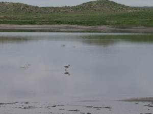
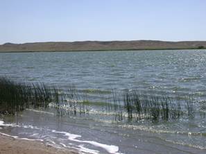
View of
|
|
|
Conceptual models of lake salinity
|
|

|
Aquifer
characterization - Geoprobe
|
|
|
Todd Halihan fishing
for plumes with ER Applications
|
ER geophysical plume rendition by Todd Halihan
|
|
SanDrill program
|
Where is Ogallala?
|
|
Collecting water table data from stock wells
|
Water Table Mapping
|
|
Testing a new frequency domain EM technique
|
Collecting ER data near Gimlet Lake
|
|
PhD Student, John B. Ong
working with piezometers
|
Working with potentiomanometer
|


